When most people turn on the faucet, they give little thought to where the water comes from. But Springfield has one of the best water systems in New England, water that has been ranked nationally, all due to the foresight the city had over 100 years ago.
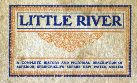
I picked up a fascinating book on eBay describing nearly everything you might want to know about Springfield's water works. It is entitled Little River: A complete history and pictorial description of superior Springfield's superb new water system. It was published in 1910.
Early Reservoirs
According to the book King's Handbook of Springfield, published in 1884, prior to 1843 the city's water was supplied mainly by private wells. In that year, a reservoir, with eight miles of log pipes, was built by Hon. Charles Stearns on what was called "the site of the present Lombard Reservoir", which was located in the Liberty Heights neighborhood, near Freeman Terrace, off Carew St.

The former location is now a wooded/marsh area, with part of the site underneath Route 291.

In 1848 the Springfield Aqueduct Company was chartered, succeeded by the City Aqueduct Company in 1860. This company was reported as controlling "the Lombard Reservoir and the two Van Horn reservoirs", the latter of which were presumably built in the preceding 12 years.
In 1873 the city purchased those three reservoirs. It also started constructing the Ludlow Reservoir, which lies in an area known as Cherry Valley, off Route 21 in Ludlow. This reservoir was completed in 1875, and it increased the capacity over the old reservoirs by twenty times.
The Ludlow Reservoir
Although the Ludlow Reservoir improved both the water capacity and the water pressure in the higher parts of town, it was not without its disadvantages. King's Handbook reports that "The water from the main reservoir is, during the winter months, pure in taste and color, but, during a part of the summer, becomes less clear and somewhat unpalatable."
A green scum was present on the surface of the reservoir each summer, described as "parasitic" by Dr. George Dimmock, since it ate away the carcases of the dead fish that washed up on its shores. But, as a small consolation, "deleterious influences have not generally been attributed by the local physicians to the Ludlow water, and it may be said to be, like a singed cat, better than it looks".
It's no wonder Springfield began looking elsewhere for its water supply.
The Little river
By 1904, Springfield needed to find a new water supply. The Ludlow reservoir was both inadequate and unsanitary. The city first suggested diverting the Westfield River in Huntington, but Holyoke and Westfield strongly opposed this plan so it was rejected by the state legislature.
Expansion of the Ludlow Reservoir, with the addition of filtering, was explored, but no technology at the time had successfully filtered such a unsuitable supply.
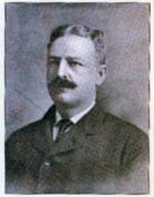
 Everett StoneSpringfield Mayor Everett E. Stone instituted a private examination of the Little river in Westfield by expert engineer Allen Hazen of New York. Hazen determined that the Ludlow reservoir would be, at best, a temporary and difficult solution, and that the Little river was the best answer. The project was started in September 1907 and was completed in December 1909, at a cost of just over $2 million.
Technical details
The engineering behind the reservoir system is probably only interesting to engineering-types, but I'll try and distill it down a bit. The reservoir consists of five major parts.
Storage reservoir at Borden brook, with a 2.5 million gallon capacity.
The Cobble Mountain reservoir, located in the towns of Russell and Blandford, with a 75 million gallon capacity.
The Cobble Mountain settling basin, with a capacity of 40 million gallons.
The underground filter chambers, with a capacity of 30 million gallons. Here's a view of the interior.

The Provin Mountain reservoir, with a capacity of 16 million gallons. This reservoir is completely underground, and sits at the top of a mountain, 404 feet above sea level! Here is a picture of it during construction:

Something that people may not realize is that the water from the reservoirs actually passes through Cobble Mountain on its way to Provin Mountain. Here's a picture of the interior of the tunnel:

Construction was performed by over 5,000 laborers, although at any given time only 1,000 were employed. These men mostly came from Springfield, Boston, and New York, and they lived in camps near the work sites, 14 miles from civilization. They were furnished by a labor supply company who received compensation by selling food and supplies to the workers. Here's a picture of one of the workers, along with some ramshackle huts they lived in:

Life must have been pretty miserable for those workers, who were described as eating mostly bread and corn meal, along with spaghetti, beef stew, and canned goods.
Expansion
There have apparently been several expansions of the system since 1910. An Army Corps of Engineers document states that three more tanks were created at the Provin Mountain reservoir, one in 1932 and two more in 1958. In the late 1960's pipes were laid to tie into the Littleville Reservoir in the towns of Huntington and Chester. This reservoir was initially constructed in 1965 to store excess water to provide flood control for the Connecticut River.
Here is a map that shows points of interest in the system. The blue line is the approximate path that the water takes. If you view the satellite photo, you can see the path because nothing sits on top of it, not even any trees.
Springfield's Little River water system also supplies water to Ludlow, Agawam, Longmeadow, East Longmeadow, and at peak times, to West Springfield, Southwick, and Westfield.
The Springfield Water and Sewer Commission owns about 13,000 acres of land in the watershed area, necessary to protect the water supply. The Commission lists as backup sources the Ludlow Reservoir and the Littleville Reservoir in the towns of Huntington and Chester.
The next time you turn on that faucet for a cool glass of water, think about the 16 miles that water travels from the clear Little River system into your house.

Little river water
Thanks Ralph, great summary of the history.
a TIME for Springfield
Has anyone ever read or seen the revitalization magazine that Springfield published? I think it was from the mid 70's. I just bartered a trinket box from of a historical hotel in Springfield for it and also got some forest park photos.
It looked just like a cover from TIME magazine. I thought some of the downtown ideas were pretty great, maybe Mayor Sarno could get some ideas from that.
Cobble Mountain Resevoir
Rumors continue to surface that the dam at Cobble Mountain is unstable and poses a serious threat to the residents downstream, hence the closing of the access roads over the dam. Prior to 9/11, core sampling was in progress, rumor is that the testing resulted in documented weaknesses in the dam structure and due to fiscal constraints of the City of Springfield, the repairs required to provide the necessary measure of safeguards has been shelved. Supposedly the "taking" of the town roads was attributed to "9/11" to prevent potential terrorist attacks. The timing of the 9/11 attacks was a convenient reason to hide the actual cause. At least that's the rumor.........
Like most "rumors" this one
Like most "rumors" this one is rife with errors. The Springfield Water and Sewer Commission has spent innumerable resources to insure that the Dam can be relied upon to contain the water and not be a hazard to the surrounding communities downstream. The closing of the access road to the dam was the direct result of suggestions by U.S. Homeland Secutity personnel, as water supplies are popular targets of terrorists. The financial condition of the City of Springfield has no bearing on the resources available to the water system, as the Springfield Water and Sewer Commission, is a seperate body politic, and not a department of the City. It's revenues are derived solely from it's water and wastewater fees and charges, and capital funds are both built into it's annual budget as well as financed through the issuance of bonded debt. I hope this clarifies this issue for you.
Reply to comment | Springfield-History.com
Hello, i think that i saw you visited my website thus i
got here to return the want?.I am trying to in finding
things to enhance my site!I suppose its ok to make
use of a few of your ideas!!
The 'TIME Magazine'
The 'TIME Magazine' publication is available in the Reference section of the City Library in fair condition. That was a great read in general, and also in seeing some of the initial plans to hold Downtown up after the Retail Exodus in the 1960's.
Reply to comment | Springfield-History.com
I have read so many posts about the blogger lovers but this post is genuinely a pleasant
paragraph, keep it up.
Looking for maps...
I am doing historical research and am looking for property lines of the reservoir property surrounding Cobble Mountain Reservoir. If anyone knows where to download it, please let me know via email: dwaynemaier81@gmail.com
Chlorine?
I grew up in Spfld. until about 1970. I recall being told by 'adults' that water from Cobble Mountain only needed filtering up until such time as EPA, or some other Gummint entity, demanded chlorination. Anyone know of some link? Can't find one.
Post new comment